


Drone mapping is reshaping archeological research.
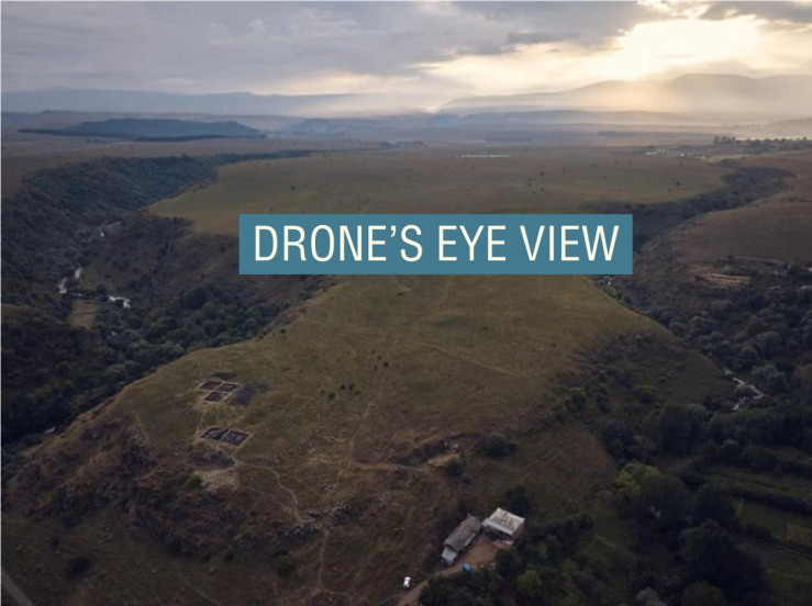
Researchers used a drone to take 11,000 images of a suspected Bronze Age fortress in Georgia’s Caucasus Mountains, allowing them to detect and map features invisible from ground level. The method showed that the site is 40 times larger than previously thought, with an outer wall more than half a mile long. Earlier maps used images from a Cold War spy satellite, but drones are cheaper and more scalable.
They “allowed us to understand the significance of the site,” one researcher said, which is considerable: The “mega fortress” is by far the largest Bronze Age structure in the region.
AD